Booth N351
#marine #electromagnetic #resistivity #subsurface #environmentalimpact #siteinvestigation
about us :
MAPPEM Geophysics offers a unique perspective into the marine subsurface and environment using tailor-made electromagnetic instruments and expertise forged along the coast of Brittany, France. We pride ourselves on providing our clients with new insights, whether that be geophysical imaging (e.g., lithology, porosity, heterogeneities, beneath acoustic marks), detecting buried objects and hazards (e.g., ferrous and non-ferrous UXO, boulders), or measuring ambient electromagnetic fields (e.g., environmental impact assessment, geothermal).
Talk with us to discover how MAPPEM’s specialised marine electromagnetic systems can deliver greater knowledge about your marine subsurface or environmental challenge.
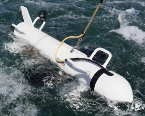
Geophysical imaging with Marine Electrical Resistivity Tomography (MERT). MAPPEM’s system introduces an electric current into the subsurface and receivers measure its response (i.e., resistivity). The resultant subsurface models can characterise lithology, porosity, geometry, nature, and beneath acoustic marks.
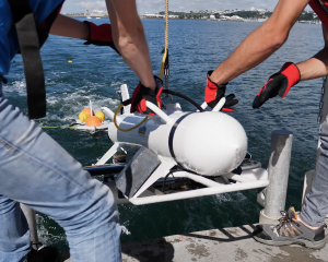
Detection and localisation of buried objects, hazards, and obstructions with electromagnetics. MAPPEM’s 3D system (MAPPEM-3D) introduces an electric current into the subsurface and dedicated data processing can determine the presence of objects. The results can be used to detect and locate boulders, archaeology, cables, ferrous and non-ferrous UXO.
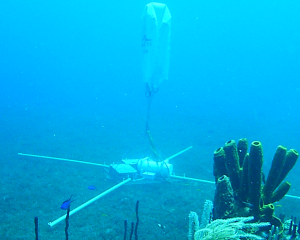
MAPPEM’s highly sensitive systems can measure the ambient electromagnetic fields in the marine environment. When coupled with habitat maps, the measurements can help assess the potential environmental impact of offshore infrastructure (e.g., cables, substations). The systems can also be used to map geothermal plays and for defence purposes.
CONTACT US
1 Rue des Ateliers, 29290 Saint-Renan, France
E-mail : contact@mappem-geophysics.com
Site web : www.mappem-geophysics.com
Tél. : +33 (0)2 98 03 23 95 – +33 (0)6 38 34 64 14
