
#CLS #Copernicus #EO #Argos #Hydrology #Innovation
about us :
CLS, a subsidiary of the French Space Agency CNES and of CNP, is a worldwide company and pioneer provider of monitoring and surveillance solutions for the Earth since 1986. Its mission is to deploy innovative space-based solutions to understand and protect our planet, and to manage its resources sustainably.
CLS employs 900 people, at its headquarters in Toulouse (France) and in its 34 other sites around the world. The company works in 5 strategic areas of activity :
– Sustainable fisheries management
– Environmental monitoring
– Maritime surveillance
– Mobility
– Energies & infrastructures monitoring
Specifically in the environmental field, these satellite tools and services offer the international community solutions for:
· Monitor inland water resources: lakes, rivers, wetlands, flooded areas, etc.
· Monitor the physical, biological and biochemical parameters of the seas and oceans. Using satellite information and data from buoys or offshore platforms, CLS continuously measures the functioning of our planet’s seas and oceans.
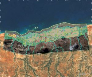
· Better manage territories using geographical data: land cover land uses. CLS photo-interpreters combine their expertise with AI to daily improve knowledge and the provision of independent information on the state of targeted territories and their uses (from the identification of the building to the characterization of entire countries).
· Monitor the functioning and developments of biodiversity: tracking animals, deforestation, invasive plants. Using in-situ sensors connected locally or via satellites (tags on animals or any other type of measuring station), CLS observes and analyzes the functioning of biodiversity across the entire planet.
· Observe and measure the impacts of climate change: fires, floods, marine submersion, droughts, earthquakes. CLS has a 24/7 team to produce maps of extreme weather events across the planet at the request of the European Union.
CLS, a major player in the European Copernicus programme.
Copernicus is a European Earth observation programme. It focuses on our planet and its environment by providing global, recurring and free data. It offers information services based on satellites and in situ data: sea levels, land cover, continental water surfaces and volumes, forests, biodiversity, impacts of climate change, etc. CLS produces and exploits these data, then makes them accessible and complementary to multiple information systems. This helps to better guide and facilitate decision-making by public and private authorities.
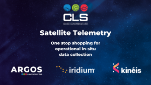
CLS is the one-stop shop for satellite telemetry services for scientific and environmental applications.
Depending on the volume of data you need to transmit for your in-situ sensors, CLS offers a complete range of solutions through the Argos & Iridium systems as well as the future Kinéis constellation. For over 30 years, CLS has been providing real-time in-situ data collection capabilities with global coverage for environmental applications such as hydrology, air quality, agriculture, oceanography, wildlife and livestock tracking and marine pollution.
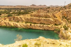
CLS is the world leader in satellite dam monitoring.
By coupling different satellite technologies (Radar, Optics and Altimetry), the CLS group is able to control and monitor the structure of the dam and its filling level using satellite data only. It is a completely new way of conceiving and understanding the monitoring and management of these strategic infrastructure: percentage of filling, millimeter monitoring of civil engineering, reconstruction of the history (over 10 years, even 30 years).
CONTACT US
Parc Technologique du Canal, 8 Rue Hermès, 31520 Ramonville-Saint-Agne, FRANCE
E-mail : jluc@groupcls.com
Tél. : +33 5 61 39 47 00 – +33 6 08 35 86 56
https://www.cls.fr/