
4025-H
#AutonomousDriving #ADAS #V2X #Navigation #GNSS #Safety
about us :
Geoflex is an hypergeolocation service operator enhancing GPS/GNSS based applications with accurate and safe positioning down to 4 centimeters accuracy on land, at sea and in the air. Geoflex provides universal hypergeolocation to trains, cars, vessels, and more, working with worldwide players in these markets. This hypergeolocation system is based upon a unique alliance between a portfolio of technology patents developed for more than 10 years by French space agency CNES, and a team with 30 years experience in GNSS augmentation services.
Geoflex’s hypergeolocation service is available globally since 2018. The service, which corrects the inherent inaccuracies of Global Navigation Satellite Systems (3 to 10 meters) is available in real-time or in post processing. It works across all types of GNSS hardware receivers and includes correction data for all constellations: GPS, Glonass, Galileo and Beidou.
This groundbreaking technology was initially developed by the French space agency CNES in a research spanning 12 years. It is protected by 7 patents licensed exclusively to Geoflex, which, thanks to its 30 years team experience in GPS/GNSS, continues the co-development of the technology together with the CNES.
In addition to its core data service, Geoflex has developed a software navigation engine which includes sensor fusion with a large variety of other technologies for critical applications in automotive, rail and mobility sectors
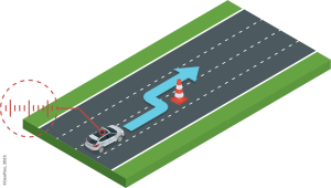
Lane level navigation
To provide a cost optimized accurate localization for Lane Level Navigation, Geoflex road tests confirm an exact positioning in the driving lane with 99,7% points detected in the correct driving lane with a mass-market GNSS and 100% with dual frequency GNSS.
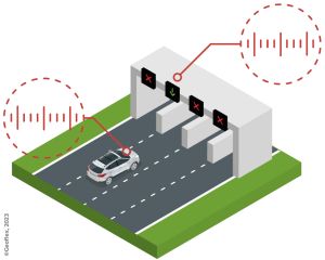
ADAS & self-driving
GNSS is the only absolute localization sensor in the car, IMU+GNSS can bring down significantly the sensor costs for multiple future applications with decimeter level localization. Additionally, ADAS applications can leverage on that backbone with extra sensor fusion (camera, lidar, …) to improve the overall availability and integrity of the system.
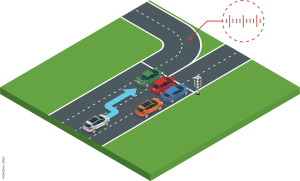
V2X
V2X communication includes a message for the car position. Geoflex precise positioning enables detection of hazards on a given lane, collision avoidance for vulnerable, truck platooning. Generally speaking, any digital twin can leverage on vehicle positions to offer new localised services.
CONTACT US
5 avenue Carnot 91300 Massy
E-mail : nicolas.burger@geoflex.fr
Tél. : +33 6 61 38 12 30
http://www.geoflex.xyz